


DATA INSIGHTS & DUE DILIGENCE
TERRAIN

MAP-BASED SEARCHING FOR PROPERTY PLANNING PROFESSIONALS.
Dye & Durham Terrain offers the most comprehensive range of property information services to Australia’s leading property planning and surveying professionals.
INTUITIVE SEARCHING & VISUALISATION
- Map-based property information searching
- Spatial searching for surveyors
- Plans, Titles, Dealings and ASIC Information
- Alerts and Monitoring Solutions
- Bulk Title Solutions
- VIC, NSW, QLD and SA property information
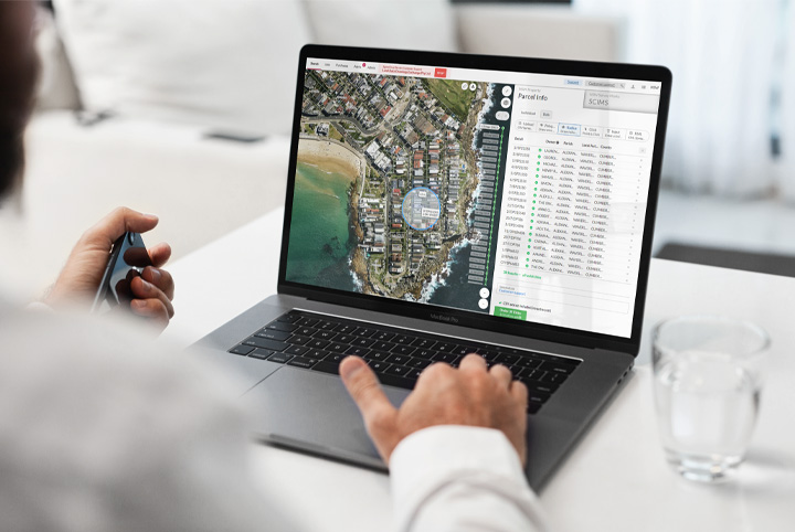
NEARMAP INTEGRATION IN TERRAIN
We offer support for Nearmap high-resolution aerial imagery, empowering property planning professionals to access accurate and up-to-date visual data directly within their parcel and title workflows.
Property planning professionals such as surveyors, asset managers, utility providers, infrastructure developers and energy suppliers can gain a clear picture of land parcels with precision and detail to make smarter, more informed decisions.
This integration enhances your workflow efficiency by removing the need for switching between multiple tools for high-resolution aerial imagery and helps you to leverage your existing investment in Nearmap by enabling you to use your existing license without any complicated setup.
We can now better support your business and bring more value to your work regardless of your preferred imagery vendor.
UNLOCK THE POWER OF HIGH-RES AERIAL IMAGERY
- Seamless integration: Nearmap support enables you to easily use your existing Nearmap licence within Terrain without any additional tools or costs.
- Flexibility to choose imagery provider: You now have the option to use Nearmap or Metromap depending on your preference and business needs.
- Streamlined workflow: You can access up-to-date current and historical imagery and property layers to optimise spatial workflows like bulk titles and surveying field planning.


BOOST YOUR SURVEYING OR PROPERTY PLANNING
Designed to streamline the search process, Terrain provides an intuitive experience through map-based software providing smart visualization.
BOOK A DEMO
Looking to learn more about how you can benefit from our services? Book a demo today.